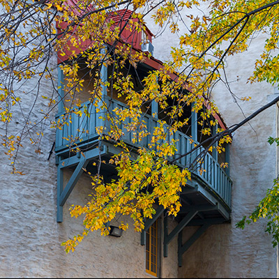
2013.9.30Early morning is always a good time to explore Old Quebec, or maybe any city. The reflection of early sun glow illustrated the quiet street. Even the most popular Petit Champlain saw no single person, no store opened either. Occasionally, there were other visitors or early runners enjoying the morning, we smiled, said “bonjour” and passed by. It’s a beautiful feeling.
Rue Sainte-Anne in the morning, Old Quebec
Old Quebec consists of the Upper Town on high land, Cap Diamant, and Lower Town by the St. Lawrence River. They are connected by Côte de la Montagne street.
Empty Côte de la Montagne street in the morning, Old Quebec
The Lower Town features some most popular attractions of Quebec City, including Petit Champlain, Notre-Dame-des-Victoires church, Fresque des Québécois and countless small shops and restaurants. It’s very crowded in daytime, but now I was almost all alone by myself.
Our morning activities were focused on the Upper Town. Old Quebec is surrounded by the fortified walls. We walked through Porte St. Louis. It’s one of the oldest gates of the ramparts. It had been rebuilt and replaced for several times in its 300 years of history.
Porte St. Louis, part of the Ramparts of Quebec City
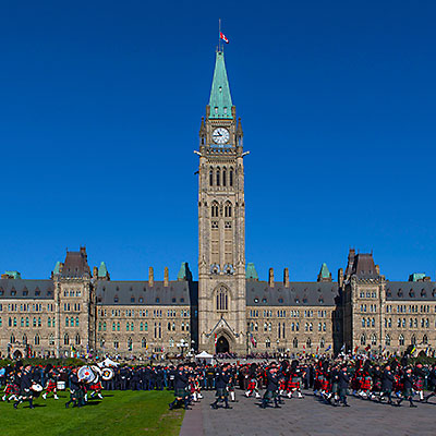
The parliament of Quebec City is in a square shape. The main building has a central clock tower stands 52 meter (171 feet) high.
Parliament Building, Quebec City
The Citadelle of Quebec is a fortress built in the early 19th century to protect the city against possible American attack. The fort is in the star-shape, which evolved from the round-shape fortification and provide better defense against cannons. To get to the core, you have to walk around inner walls. We also circled around the fortress along the external premises. I have to say that we were not very impressed, not much to see.
Near the Citadelle of Quebec
We had lunch at Savini Resto-Bar at 680 Rue Grande-Allée East. These are a couple of street blocks with restaurants and hotels outside of Old Quebec wall. Savini offers a fun dining environment, but the food was so so.
We spent the afternoon in Old Quebec, mostly in the Lower Town.
A yogurt store, Old Quebec
Notre-Dame de Québec, Old Quebec
A restaurant in Petit Champlain, Old Quebec
Petit Champlain, Old Quebec
Petit Champlain, Old Quebec
Besides Côte de la Montagne, an easier option to commute between Upper Town and Lower Town is by the cable car connects Cap Diamant and Petit Champlain. We were only a few minutes too late to catch the last car so we had to climb by ourselves. At the back of Château Frontenac, there is a long promenade known as Terrasse Dufferin. Along the riverfront, the boardwalk is 60 meters above the water. It’s a perfect place for a stroll in sunset and overlook the St. Lawrence River.
Overlook St. Lawrence River from Montmorency Park National Historic Site, Old Quebec
Terrasse Dufferin, Old Quebec
We had the dinner at Chez Boulay on Saint-Jean Street. The food is inspired by the nordic cuisine. It’s colorful, creative and delicious.
Dinner at Chez Boulay, a restaurant featuring Nordic cuisine, Old Quebec
2013.9.29Sheraton Hotel is only 3 blocks way from the Parliament. I had my usual walk in the morning, to take pictures before visitors coming and to understand what places worth visiting and how much time we’d need.
As I was walking in the square of the Parliament Buildings, I understand why it’s the most popular attractions of the city. Open settings, grand architecture, dignified buildings, but the most beautiful place was the section between the Main Block and East Block. The trees’ color has started turning. Immersed in the morning fog, it’s quite and peaceful, very different feeling compared to the rigid buildings steps away.
East Block of the Parliament Buildings, Ottawa
Southeast corner of the Centre Block of the Parliament Buildings, Ottawa
Overlook Ottawa River at the back of Centre Block of the Parliament Hill, Ottawa
From the back of the Centre Block, I walked down from the Parliament Hill, By the bridge of Wellington St., steps led me down to the Rideau Canal. The Canal was built at the beginning of 19th century as a preventive measure in case of Americans invasion. It connects Ottawa River and Lake Ontario at Kingston, where we stopped for coffee the earlier night, with 200 km in length. It’s still operated today for leisure use.
Locks on Rideau Canal and the Alexandra Bridge over the Ottawa River, Ottawa
Every lock on Rideau Canal is numbered. The lock is strong enough for people walking over it. The canal system is a UNESCO World Heritage Site.
Reflection of the Parliament Hill in Rideau Canal, Ottawa
Château Laurier is a grand hotel with 100 year of history. It’s located right next to the Rideau Canal. I walked along the canal underneath the bridge and climbed up from the other side. I walked over the Confederation Square and returned to the hotel.
I returned to Parliament Hill with my wife and in-laws 1 hour later. Centennial Flame was lit on. It happened to be the Canadian Police And Peace Officer’s Memorial Day, which is on the last Sunday of September of every year since 1998. We have a chance to view the memorial service in front of the Police Memorium by the Summer Gazebo and watched the parade on the front lawn of Parliament Hill.
Canadian Police And Peace Officer’s Memorial in front of the Police Memorium by the Summer Gazebo, Ottawa
Canadian Police And Peace Officer’s Memorial parade under the Peace Tower of the Centre Block, Ottawa
Canadian Police And Peace Officer’s Memorial, Ottawa
We took the same route that I walked earlier in the morning. We had some breakfast at BridgeHead Coffee, then we had a quick tour around Ottawa‘s Lower Town without leaving our car, partly because of the safety concern but mostly because we’d have another city to visit.
Leaving Ottawa, we soon enter Quebec province. It’s well known that the official language of Quebec is French, but we were still surprised that English just disappeared from all signs. My father-in-law had done researches in France for a couple of years. He could read and speak French, which was very helpful. At one time, we stopped at a visitor center and asked for maps. The lady at the help desk helped us but just like she helped any other visitor; then my father-in-law started talking with her in French – the lady become enthusiastic almost right away. She brought more maps and brochures and told us other attractions worth visiting.
At 2pm, we arrived at Montreal, the largest city in Quebec. Montreal had been the commercial center of Canada until 70’s and remained to be a diversified and active city for commerce, technology and world affairs. However, we only planned to be here for several hour and the only area we’d visit was the Old Montreal.
Old Montreal is a historic area by the waterfront of St. Lawrence River. There are enough parking space by Rue Saint-Antoine behind the city hall. The center of the Old Montreal is the Place Jacques-Cartier square. We walked to the Old Port and Rue Saint-Amable, then we had lunch at one of many restaurants at the square. It started getting dark when we walked to Notre-Dame de Montréal Basilica. We didn’t get a chance to get in.
Montreal City Hall, Old Montreal
Walking street, Rue Saint-Amable, Old Montreal
Place Jacques-Cartier square, Old Montreal
We drove to the Mount Royal Park. The very top of the hill was closed to vehicles, so we were not able to view Montreal’s skyline from the top. On the waist of the mountain, there is an vista point. We could overlook the northern part of the city with the Olympic Stadium in sight.
Overlook North Montreal from Mount Royal Park, Montreal
A pair of raccoons at the vista point. They were very affectionate. Montreal
Our schedule was like group tour that could only taste the city in a very superficial way. We left Montreal at 5:30pm. It’d be a two and half hour drive to reach Quebec city. There were not a lot of car on the highway. We almost passed by Quebec City without noticing the sign. Luckily, we were able to charge the cell phone in the car and load the map.
We located Boulevard Laurier, which led us straightly into the Old Quebec. The street became tree-lined and then the buildings along the street appeared to be more elegant. After we went through a stone arch, the street suddenly became very narrow. Navigating through the European-style maze-like city grid, we checked into our hotel, Hôtel Champlain Vieux Québec. From the window, we had a view of grand Château Frontenac.
Night view of Château Frontenac from Hôtel Champlain Vieux Québec, Quebec City
We went out to see if there was any food to eat, but it’s too late and most restaurants were closing. We returned to the hotel, had some nice tea at the lobby. With the hot water, we were able to make our reserved instant noodles as dinner.
2013.9.27~28Compared with our other travel destinations, a trip to visit Eastern Canadian cities is definitely much less exotic. Our original plan was to go to Puerto Rico, but my in-laws preferred city tours. In the end, we had nice trip. Not only we spent some quality time with the family, but the fall color around Quebec and Maine was the best I had ever seen, and my father-in-law had an opportunity to show off his French speaking skills.
We had a hectic schedule for the first three days. We arrived at Toronto at 10pm on Oct. 27th. Without other customers, it took Hertz an hour to find a car for us, partly because they had to bring a car with an American plate for us as we’re gonna return the car at Boston. The cost was surprisingly cheap though. It’s almost midnight when we checked into our hotel, Westin Harbour Castle, but it’s still early in California time. We had some snacks at the restaurant on hotel’s first floor.
Midnight snacks at the Westin Harbour Castle, Toronto
The hotel is located on the waterfront of Lake Ontario. Although we booked city-view rooms, the one we had was at the corner – The city lights was vibrant seeing from one window, and we had a partial view of the lake from the other.
Toronto Downtown, from the Westin Harbour Castle, Toronto
Toronto lake side view at night, from the Westin Harbour Castle, Toronto
The second day morning, sunrise behind the cloud over Lake Ontario was quite dramatic. As usual, I had a morning walk around the hotel, mostly trying to find out how long it would take to walk to the CN tower. It’s the Saturday morning. Not many pedestrians on the street, but there were a lot of constructions going on under the highway overpass.
Sunrise over Lake Ontario, Toronto
The boardwalk by Lake Ontario, Toronto
Harbour Square, Toronto
CN Tower
I bought a hot-dog on a food stand by the hotel on my way back. After a quick breakfast, we were heading to the CN tower. It’s Saturday, we were worried that the line could be long so we made it our first destination. It’s a 20-minute walk from the hotel. As we got there at 9:30am, there was no line at all. If we hadn’t reserved the tickets online, we could buy the tickets right away. Instead, because I never received the tickets they were supposed to mail to me after the reservation, we had to wait at the entrance for 10 minutes while they were getting our tickets somewhere in the office.
The security check was quite rigorous. As I passed through a security gate, the gate shot out air steams continuously from multiple directions – I don’t know what it’s used for. Like other attractions, right after passing the entrance, there is a photo spot that visitors are photographed against a wall featuring CN tower overlooking the city.
It only takes a minute to reach the LookOut level at a height of 346 meter. Half side of the floor is taken by the Horizons Restaurant. Through the glass window of the other half, the view of the west side of the city and Lake Ontario was fascinating, Unfortunately, we only had the clear view for less than 5 minutes before the cloud moved in. Standing on top of the cloud, we couldn’t see anything.
Overlook Toronto from CN tower
Going one level down, you can walk to the outside and around the tower at the Outdoor SkyTerrace, and have a 360 degree view of the city, but your sight will be cluttered by the wire fence. The most interesting feature of CN tower is the Glass Floor. With a view 342-meter straight down, even I knew it’s absolutely safe, my first several steps were very cautious.
Viewing through the Glass Floor, CN Tower, Toronto
City Hall
We took taxi to the city hall and walked through the square. The city hall was opened in 1965 to replace the old city hall next to it across the street. The architecture is impressive and futuristic, especially considering that it’s built 50 years ago,
Toronto City Hall
The Old City Hall reflected on the glass exterior of Eaton Centre, Toronto
Eaton Centre and Yonge Street
Next to the Old City Hall is Toronto’s most popular tourist attraction, Eaton Centre Shopping Mall. As one of the most successful stores of Eaton’s chain since its opening in 1977, Eaton Centre is so profitable that it’s said that it had been keeping Eaton’s business alive for 20 years until it went bankrupt in 1999. Eaton Centre retained its name and today, it’s still one of North America’s top shopping destinations.
Eaton Centre, Toronto
We made a brief stop at Eaton Centre and walked back to our hotel along Yonge Street. Yonge Street is famed to be the longest street in the world. It’s southern end is mostly taken by bank and office buildings.
Island Ferry
What we planed to do next was to take the ferry to Toronto Islands. The ferry to the Centre Island runs every half an hour, while to Hanlan’s Point and Ward’s Island is once every an hour. The dock is right next to our hotel. We checked out of the hotel and asked the bell desk to store our bags. We planed to take the ferry at 1pm. Although there were already many people waiting before the door was opened, the boat is big enough to get everyone on board.
People get onto Toronto Island Ferry
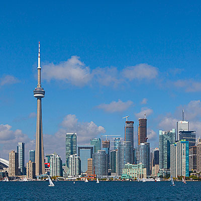
You should go to the second deck and stay at the very rear of the boat for the best view of the city when the ship is leaving for the island. Toronto’s skyline is one of the best!
Toronto skyline, from Centre Island Ferry
It takes about 10 minutes for the ferry to get to the Centre Island. We spend only an hour on the island and walked through the park to the lake shore. Summer had passed. Not many people on the Manitou Beach.
Shores of Lake Ontario, Toronto Island Park
Toronto Island Park
It’s said that Toronto has the best Chinese food outside of Eastern Asia. It could very much be true. We went to 辛香汇 at Thornhill. Definitely much better than Northern California. There were many new dishes that were recently introduced from China. We ordered a lot of food, there would be no Chinese food in the next several days.
We resupplied at T & T Supermarket (大统华) and it’s well over 4pm as we left Toronto. We’d drive 5 hours and stay overnight at Ottawa. Dark soon fell. We made a stop at Kingston, having a coffee and refreshing ourselves. My father-in-law played Chinese songs stored in his cell phone to keep us entertained for the last two hours of the trip. At almost 11pm, we checked into Sheraton Hotel at downtown Ottawa.
2012.12.31After returned to the main road, B144, we were leaving Serengeti National Park and entering Ngorongoro Conservation Area. Along the rugged road that we came three days ago, we arrived at Ngorongoro Crate at 9:30am.
Ngorongoro Crate was created by the volcano eruption and collapsion 2 to 3 million years ago. The original volcano could be as high as 19,000 feet. Today, it is the largest and the best preserved volcanic caldera in the world. Visitors can only enter the crater from the north entrance and are allowed to stay up to 6 hours on the crater’s floor.
Overlook Lake Makat in Ngorongoro Crater from the north entrance
Drive down to the floor of Ngorongoro Crater from the rim, which is 2000 feet above the floor. Stopping during descending is prohibited.
Because of the large size of the crater and the natural enclosure created by the volcano caldera, Ngorongoro crater forms its own ecosystem. For 25,000 large animals living inside the crater, mostly ungulates, don’t leave the crater in their whole lives; but some, for example, a portion of wildebeests, zebras and buffaloes, do migrate according to the season. The major animals that are missing in the crater are impala, giraffe, cheetah and leopard.
Zebras, Ngorongoro Crater
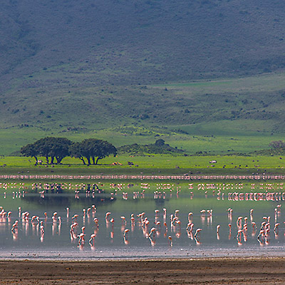
Lesser Flamingos on Lake Makat, a seasonal salt lake in Ngorongoro Crater
Buffaloes, Ngorongoro Crater
Hyenas, Ngorongoro Crater
A species that is critically endangered and can be found within the crater is the black rhino. We were very lucky to see one of them, although in a very far range. The population dropped rapidly because of poaching activities. The government has to take serious steps to protect endangered species. We often saw armed rangers patrolling the area.
A black rhino in very far range. It looked white because of mud on the body. Ngorongoro Crater.
A adult male lion in Ngorongoro Crater
The sheer size of the crater and the panorama view of the caldera wall are overwhelming. We roamed around for 3 hours within the crater, then we ascended from its east wall, drove a quarter of the cycle and returned to the south entrance.
Panorama view from the floor of Ngorongoro Crater
The crater has its own weather – sunshine and storm in Ngorongoro Crater
We’d still have almost 10 hours before our flight took off. On our final leg, we drove through all the great places we have been to. A while after we descended from the Rift Valley, a typical early afternoon thunderstorm came and lasted for about an hour. As we turned to the road to Arusha, the rain stopped. It looked like nothing would prevent us from having a very smooth trip.
Tanzania’s Staple Food – Bananas, Mto wa Mbu near Rift Valley
Maasai’s village, near Arusha
Maasai’s market, near Arusha
Rainbow over North Tanzania plains, near Arusha
Things started happening after we stopped to take pictures for this beautiful rainbow. The car just couldn’t start. It’s only 30 to 40 miles from Arusha. Justin called the office but they didn’t have a car immediately available to take us. We anxiously waited in the car for 40 minutes, luckily another car of the same company passed by and the driver must be more experienced than Justin. He in fact removed something from the car under the hood then the car just started fine. Right before we enter Arusha city, the rare-left tire got flat. We had backup, so we got off the car and Justin changed tire. It’s almost 6pm now. The city streets were just jammed. After we finally drove through Arusha and left all the noise behind, it already passed 7pm. Although we knew that we’d still have enough time, everyone couldn’t help getting a little nervous, because it’s getting dark, another car problem would cause us missing the flight.
In the end, nothing happened. We arrived at the airport at 8:30pm. The only thing we probably missed was, if without those issues, we’d have a good chance to see Mt. Kilimanjaro on our way to the airport. What we had seen actually was the dimmest hint of the mountain body, which we couldn’t even convince ourselves. We thanked Justin for his wonderful work and said goodbye to him. We would have a long trip back home.
We had a great safari trip that is much exceeded our expectations. We knew we would visit great national parks and see wildlife, but we didn’t expect wide variety of landscapes, including lakes, forest, mountains, endless flat plains and rolling savanna, and rich history of natural environment and human kind. With the world-class safari lodges, we were able to experience all these wonders in comfort. Northern Tanzania is one of our dream destinations and we had our dream come true.
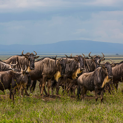
2012.12.30~31The road run straightly towards southeast as we were driving to Naabi Gate. Wildebeests and zebras spread on both sides of the road as far as the eye could see. We were in the middle of Serengeti’s great migration.
The migration is the yearly movement of as many as 1.5 million wildebeests around Serengeti plains, covering more than 1000 miles. Large numbers of other animals, especially zebras, gazelles and impalas travel with them. Driven by where the rain and fresh grazing is, the annual pattern of the movement is largely predictable. At the end of the year, the herds primarily gathered at the short-grass land of Southern Serengeti, Ndutu and part of Ngorongoro Conservation Area.
Wildebeests in migration, Serengeti National Park
Grant’s Gazelle, Serengeti National Park
Wildebeests in migration, Serengeti National Park
Mountain Zebras in migration, Serengeti National Park
Wildebeests in migration, Serengeti National Park
We arrived at Naabi Gate at 12 pm and we climbed to the top of the Naabi Hill again. Two days ago, nothing could be seen on the Southern Serengeti plain, now animals in migration were all over around us.
Overlook Southern Serengeti and animals in migration from Naabi Hill
The early afternoon storm approached us from the east. We returned to the car, had our lunch while waiting for the rain to move over us.
Storm is approaching Naabi Hill, Serengeti National Park
Not very far after passing Naabi Gate, we went off the road to the south. Because we booked our trip too late, no hotel on the rim of Ngorongoro Crater could be found. We would stay overnight at Lake Ndutu area. The storm left a mess on the grass plain. Justin had to drive carefully to not to get stuck in the mud puddles.
Mountain Zebra, Serengeti National Park
After an hour and a half, the short grass plains gave away to the woodlands. In fact, Ndutu area is a primary location for wildlife watching during migration, not only because of the lake as the water source, but also the woodlands keep wildebeests and zebras safe from their predators. During January and February, about quarter of wildebeests (300K to 400K) give birth within a short window of two or three weeks. Although this synchronized birthing seems to be a feast for predators, actually they are quickly becoming satiated so that eventually more calves survive.
It took us some time to find our camp, Ang’ata Migration Camp. The camp sits on the high land of the rolling savanna overlooking Lake Ndutu. At check-in, the staff told us that the waste is first processed by chemicals in the bucket in tent’s restroom, then “after you’ve done your business, we will take your business to the business center and they will be buried underground”. It’s a quite humorous way to explain an unpleasant fact.
After some rest, we went out for a game drive around the region. Lake Ndutu is a good place for bird watching.
Bateleur Eagle, Lake Ndutu
Black Kite, Lake Ndutu
We carefully tried to avoid crossing the lakebed because it’s too muddy until Justin got calls from other guides reporting that they saw a leopard on the other side. As we arrived to the spot, there were already 5 or 6 cars. It seems to be a baby leopard, but we were able to get quite close only about 30~40 feet.
A small leopard resting on the branch, Lake Ndutu
We were joined by some professional photographers and their upgraded jeeps, Lake Ndutu.
On our way returning to the camp, we saw two giraffes fighting as others passed by. The two literally threw their necks to each other, collided and tangled together. It’s hard to imagine that the animal so elegant whose fight can be so brutal. What we saw was just a gentle skirmish.
Giraffe fight, Lake Ndutu
We had a nice dinner with fried tilapia. When they were introduced into China, it’s called “Africa Carp“, but we didn’t know that they indeed came from Africa.
The second day morning, we left the camp at 7 am. Ang’ata Camp is located in the middle of the woodland, we have seen giraffes and elephants very close to the tents. Justin said that we had just been visited by a lion in the morning. It seemed that animals were moving into the area.
Ang’ata Migration Camp in sunrise, Lake Ndutu
Migration, Lake Ndutu
As we returned to the short-grass plains, we were surrounded by thousands of thousands of wildebeests. No obvious leaders, they were all walking towards the Lake Ndutu direction, seemingly knowing there would be fresh grazing waiting for them. Indeed, clouds had been gathering over the southern sky. The wildebeests just know the rain is coming. They have done this for millions of years.
Wildebeests in migration, Near Lake Ndutu
Wildebeests in migration, Near Lake Ndutu
Hyenas, Near Lake Ndutu
We returned to the main road, B144. Our last stop was Ngorongoro Crater.
2012.12.28~30We reached Naabi Gate at 3:20 pm. This is the southeast entrance of Serengeti National Park. The gate is built next to the Naabi Hill. Unlike most other Kopjes in the Serengeti plains, visitors are allowed to walk off their jeeps and climb the hill. When Justin went to the office to check in, we walked the trail up. It’s an ideal vantage point to view the surrounding area from the top of the hill. Southern Serengeti is a vast and seemingly endless grassland, not even a single tree can be seen. The migration had not reached here yet. The total nothingness was quite a surprise to us.
Endless grassland in south Serengeti, the entrance of Serengeti National Park.
Leaving Naabi Gate, the road run straight towards northwest. Driving about half an hour, we saw more than ten cars stopped at the road side. There was a female cheetah by herself at around 200 feet from us.
A female cheetah at Serengeti National Park.
We had a game drive on our way to the camp. It’s been all gravel roads since we left Ngorongoro. We had to take three German girls with us because their car got a flat tire. We should help each other in the wild, but it’s not very convenient when all five adults trying to stand up to watch animals in a mid-size car.
Saddle-billed Stork, Serengeti National Park
Grey-crowned Crane, Serengeti National Park
We got to our camp, Ang’ata Camps, at 7 pm. The camp has about 8 to 10 tents. In the center, one bigger tent is used as the dining room, a smaller one is decorated like a living room with a small library in it. Compared with where we lived at Tarangire and Lake Manyara, Ang’ata Camps is much less luxury, but Serengeti is also much further from the city, one should feel fortunate to have a comfort place to spend the night.
At first, we were curious about the pair of buckets hanging high outside of each tent. In fact, in order to provide hot shower for visitors, the staff of the camp have to cook the water with a big pot in a central area; then two workers carry the pot to each tent and pour the hot water into one bucket and the cold water into the other. The water flows into the tent after mixed. It’s not easy to offer these services in an environmental-friendly way in such a remote place. Of course, they charge the premium too.
Our tent in Ang’ata Camps, Serengeti National Park
We started our game driver on the second day at the early morning. Southern Serengeti plain sees more animals in the wet season.
Hartebeest, a species of antelope that can only be found in Africa, Serengeti National Park
Baboon troop – baboon’s hierarchical social system, Serengeti National Park
Hippo pod – although they huddle closely, hippos are not social animals, Serengeti National Park
At around 10 am, someone called Justin over the phone and apparently told him there was something interesting somewhere. When we got there, we saw at least 30 jeeps around a kopje. There was a female leopard with her two cubs on the kopje. Leopards are good climbers. They spend most of time stay on the tree branches or hills. This time, she seemed didn’t like to be surrounded by so many bystanders and worried about her cubs safety, so she kept her cubs around and carried them in her mouth and hid them behind rocks.
A leopard with her cubs, Serengeti National Park
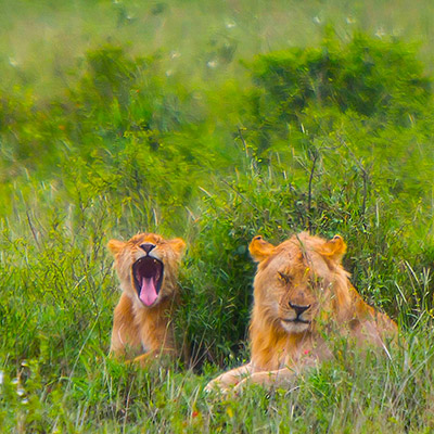
We watched the leopard family around the kopje for half an hour. It started drizzling from time to time. Continue on our game drive, we saw two young lions sitting in the underbrush, one male and one female. Interestingly, giraffes and antelopes could be seen not very far behind them. Because lions were out of their flight zone, these animals didn’t seem worried at all.
Young lions with a giraffe in sight, Serengeti National Park
Young lions, Serengeti National Park
As we on our way back to the camp for lunch, the cloud started gathering in the sky. A huge thunderstorm was upon us.
Game drive in a rainy day at Serengeti National Park
After our lunch, as we were about to leave for afternoon game drive, the rain started pouring. I hadn’t seen such heavy rain for long time. The rain, like a curtain, hung outside the tent. It’s all looked blue and dark outside. The cloud was so thick, it looked like the night had fallen. Sometimes, the sky at distance showed some hints of light and gave us hope that the rain was about to stop, but soon the light gave up and the dark side took over again.
Ang’ata Camps after the heavy rain, Serengeti National Park
Seronera area after the thunderstorm, near Ang’ata Camps, Serengeti National Park
At 5 pm, the rain finally stopped after 3 hours. We didn’t have much time and we didn’t want to get stuck in the mud either, so Justin decided to take us for a short drive to Seronera Information Center. Seronera information center and the wildlife office sit next to each other on the kopje, surrounded by large candelabra trees. The center holds an open exhibition that explains Serengeti’s ecosystem.
Candelabra trees around Seronera Information Center, Serengeti National Park
We were shocked by many huge rodent-like animals all over the place. They are hyraxes – in fact, more closely related to elephants. Can you imagine that? Hyraxes here had become very used to humans. The were at every corner, on every tree and made the huge noise.
A tree hyrax eating leaves in Seronera Information Center.
We had a short excursion before retreated to the camp. Unlike more luxury camps in other parks, Ang’ata Camps doesn’t have a dinner menu. The dinner has a soup, 2 or 3 main dishes, usually chicken and veggies, in large panes, and bread and rice.
Buffaloes, Serengeti National Park.
We checked out Ang’ata Camps the third morning. During our stay, we met another Chinese visitor, who happened to be one of two leading actresses in a famous movie series in China 30 years ago. What surprised me was, although she married to an American, her two sons spoke fluent Chinese.
Sunrise over Serengeti National Park.
We continued our game drive on our way leaving the park. We met another troop of baboons. Adult baboons are powerful animals. They are very terrestrial. One of the males showed off his teeth to warn us.
Mother and son, baboon, Serengeti National Park.
Powerful jaw and sharp teeth, baboon, Serengeti National Park.
Impalas often form into herds based on the sex and age, This is a group of female impalas.
Impala herd, Serengeti National Park.
At one point, we were driving into some hippos’ territory next to a hippo pool. Hippos stay in the water to remain cool during the day, but now several hippos were enjoying the morning walk and having breakfast in grass bushes. Hippos may seem clumsy, gentle or sometimes cute, they are one of most aggressive animals. In fact, hippos kill more humans than any other large animals in African.
A hippo in the bush. Don’t be fooled by their innocent looks, Hippo is one of the deadliest animals in Africa. Serengeti National Park.
The highlight came when we reached the south of the park facing an open savanna. There were totally 9 lions right in front of us, all females and youths. At first, we were only able to count 5 as others stayed low on the ground. As they revealed themselves one after another, people started cheering in low voices. There were four adults in the middle gazing at far distance away from us. Justin stood on top of our car but he couldn’t see what they are looking at. Lions didn’t make any move. After 20 minutes, they lost interests and started leaving.
A group of lions possibly looking at their prey, Serengeti National Park.
Lions in Serengeti National Park.
At this time of the year, wildebeests in migration mostly gathered at the area between Serengeti National Park and Ngorongoro Conservation Area. When we came two days earlier, the herds hadn’t all moved in. Now, we were at the middle of the great migration.
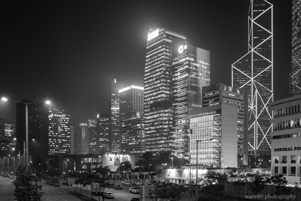
OpenStack is an open-source project for cloud computing. While started only 3 years ago, it’s growing up quickly and started picking up momentums in recent years, together with new tech trends/hypes, such as Virtualization, SDN, NFV and son on. I went to Hong Kong earlier this month to attend OpenStack Summit. It’s the first summit held outside of the US. With more than 3,500 attendees, it’s clear that there were a lot of enthusiasm around OpenStack.
As an OpenStack Network Model (Neutron) contributor, I was mostly in the developer sessions. This is my first time been to the summit. It’s interesting to note that OpenStack community is very much like United Nations. Different companies with different agenda come together to try to find some common ground moving forward. There are powerful companies, but the less powerful ones can dynamically form into groups based on interests so their ideas can be more influential. People here are competitors and colleagues at the same time. Together, many innovations are incubated.
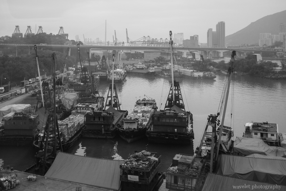
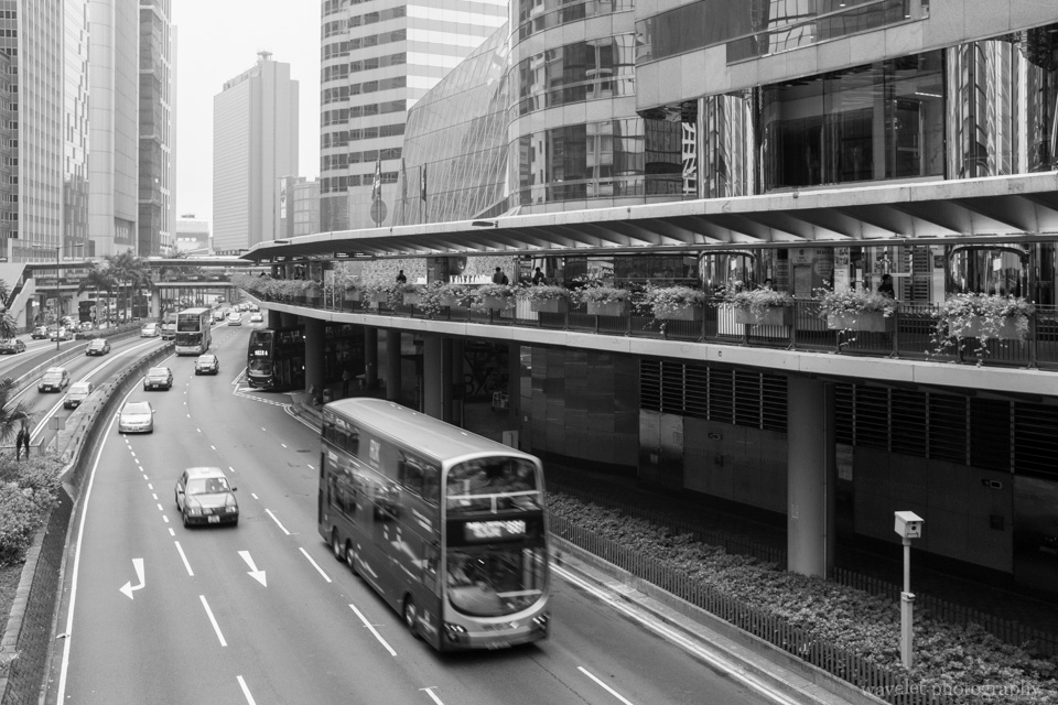
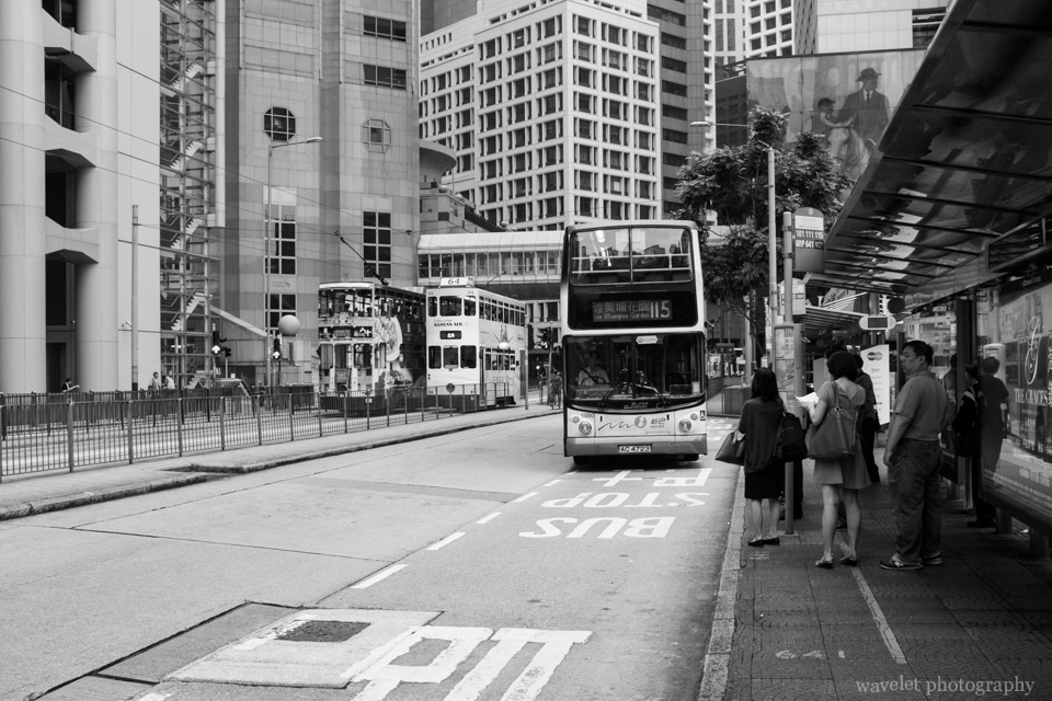
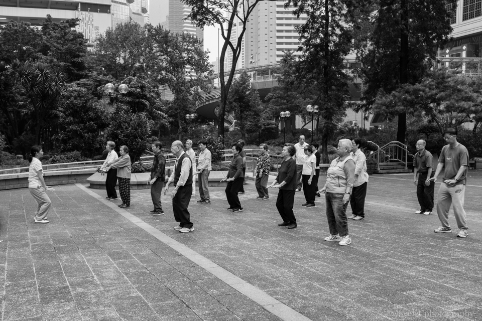
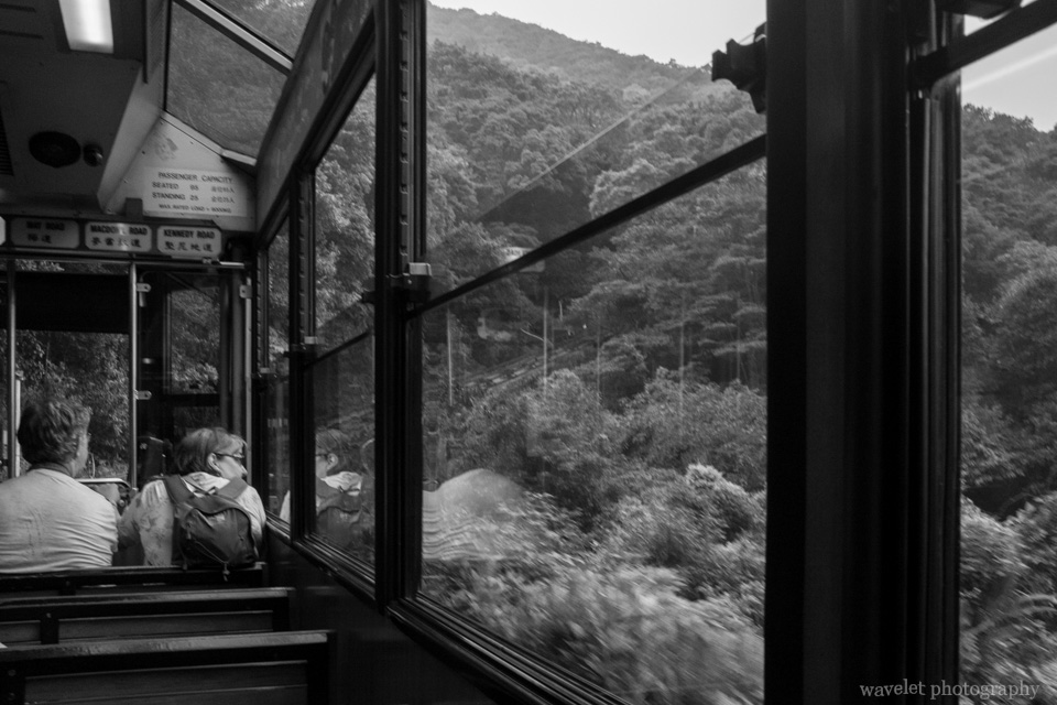
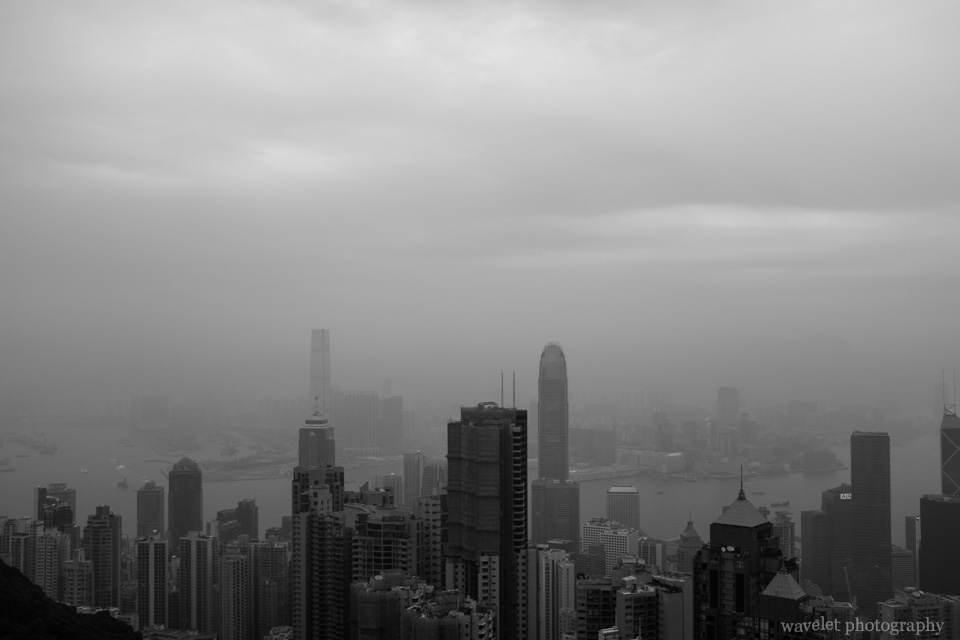
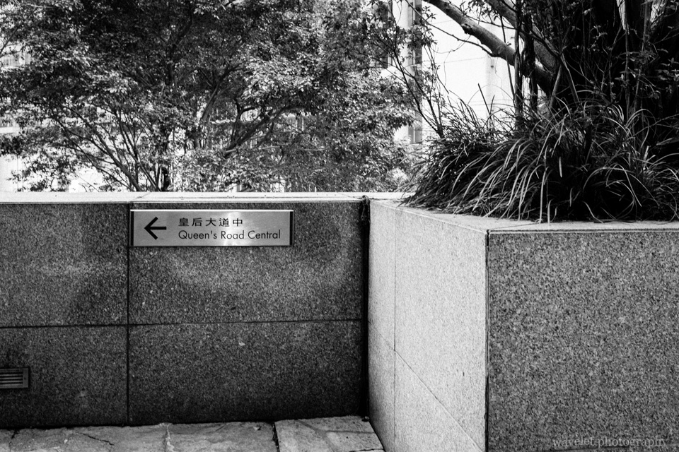
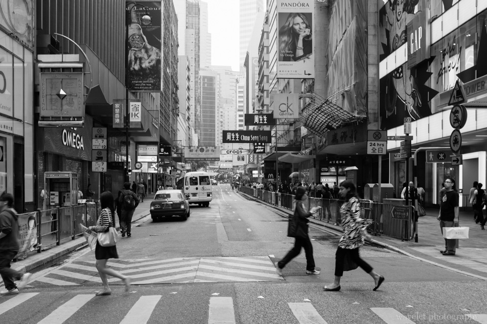
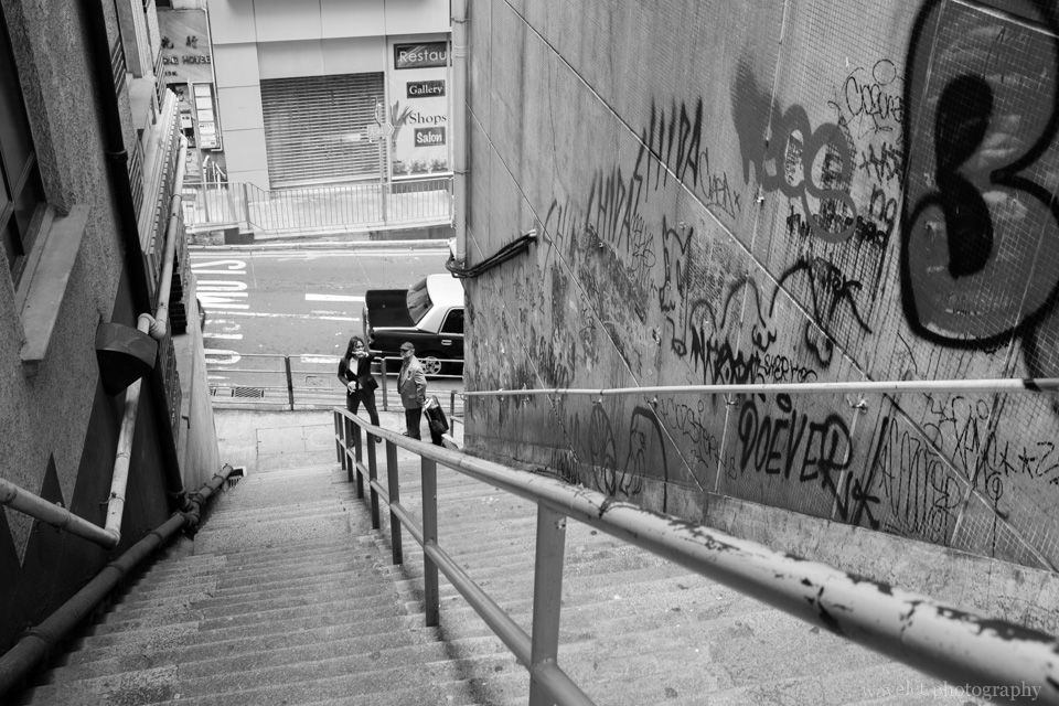
There were a lot of interesting sessions during the summit, so I only managed to go to the city twice in one relatively free day. Taking Airport Express, from the Expo to the city Central is a half-an-hour ride. 九龍, 尖沙咀, 蘭桂坊, 銅鑼灣, 皇后大道, for those names that I heard so many times from Hong Kong movies and TV series, I finally had a chance to see them in person.
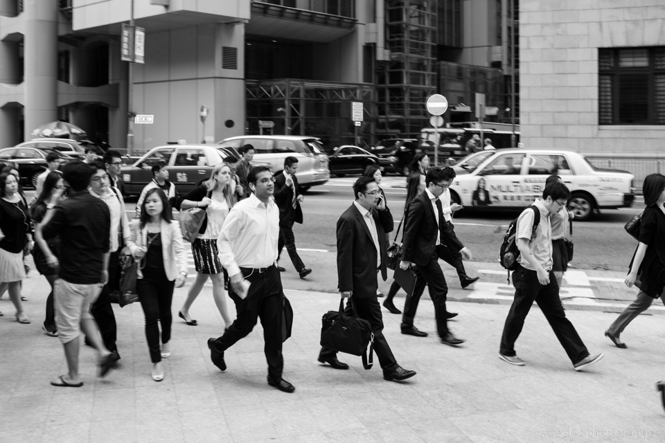
I didn’t bring my bulky DSLR, but rented a Fujifilm X100S based on friends’ recommendation. I also for the first time experimented street photography in manual focus mode. I converted the picture into BW in the post-processing. I am totally a newbie in all these 3 aspects (street photography, manual mode and BW pictures).
2012.12.28We left Tindiga Tented Camp at 8:00am, drove back on the same road that we came upon. The distance seems much shorter on our way return. After 1 hour or so, we were so happy to be on the paved road again, but Justin told us it wouldn’t last long – it would be bumpy road all the way after passing Ngorongoro Crater.
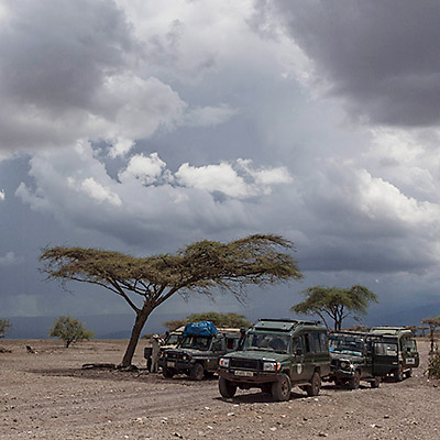
Kept driving for 20 minutes, we were at the foot of Ngorongoro Crater. The road was jammed with safari jeeps in front of the entrance. The computer system was down, so the ticketing process moved very slowly. We took our time to see the exhibition in the visitor center while Justin was in line in a room filled with local guides waiting to buy the ticket. We noticed that almost all safari jeeps were Toyota Land Cruiser. Justin said that the model is sturdy and easy to maintain. The only downside compared to Land Rover is that Land Cruiser is heavier. During the rain season, it has greater chance to get stuck in the mud.
Safari jeeps waiting to enter Ngorongoro Conservation Area.
Stuffed animals in a safari jeep outside of Ngorongoro Conservation Area.
Entrance of Ngorongoro Conservation Area.
After 1 hour, the computer system recovered. We got the tickets and moved on. The eastern slope of Ngorongoro Crater rises 800 meters above the surrounding terrain. The easterly trade wind drops much of its moisture and creates the dense forest at this side of the crater.
Dense vegetation in south slope of Ngorongoro crater.
The road runs on top of the crater ridge. The elevation is about 2300 meters (7500 feet). At the south side, there is a spot for visitors to overlook both inside and outside of the crater.
Overlook Ngorongoro crater from its south ridge.
We would return to Ngorongoro and get to the crater floor on our last day of the trip. For now we just cycled half way around the crater ridge. At the western side, the annual precipitation is only half of that at the eastern slope, but still enough to support prosperous grassland. The lush and fresh greens cover the hillside and extend as far as eyes can see. Justin said that wealth is counted in the number of cattle one owns in Tanzania. People living here must be rich.
Western slope of Ngorongoro volcano.
Overlook the Ngorongoro crater and Lake Makat. This is entrance for visitors to get down to the crater floor.
A Maasai village for tourist near Ngorongoro Conservation Area.
It’s amazing how fast the environment changes. After 30 minutes, we got off B144 and turned to the north. The grassland just disappeared and the area surrounding us was like a scrubby desert. Their is no clear mark of the road. We picked up a man near the main road and drop him off at the entrance of Oldupai Gorge.
Oldupai Gorge Entrance.
Oldupai Gorge is also called Olduvai Gorge, which is a misspelling of Oldupai, a commonly found wild sisal plant in the area. It is one of the most important paleoanthropology sites in the world. Discovered in 1911, Oldupai has yielded many fossils of primitive hominid and stone tools dating back 2 million years ago in the layered sediments in the gorge. These finds convinced the world that humans originally evolved in Africa.
Oldupai Gorge.
We had lunch at the resting area and listened to an lecture given by the man we picked up earlier. It’s interesting to see how the perception of a person can change so remarkably in different settings – he was a nobody in our car and now he is a authoritative scholar.
The visitor center holds educational exhibitions about discoveries in Oldupai Gorge and Laetoli, 30 miles south where the famous footprints made by early hominid 3.6 million years ago was found. It’s one of the earliest evidences of hominids walking upright. It’s fascinating to imagine the day that these 3 individuals walking side by side with elephants. The elephants must be thinking, “What a weird creature they are! Why do they walk with two feet?” In the following 3 million years, human has taken the world and elephants are still elephants. The museum has a map that illustrates the timeline of Homo sapiens’migration paths out of Africa and expansion to the world.
Vegetation of Oldupai Gorge.
Common Bulbul, Oldupai Gorge.
Agama Lizard, Oldupai Gorge.
We left Oldupai Gorge at about 2pm. The thunderstorms seemed so close, just behind those acacia trees.
Thunderstorm near Oldupai Gorge.
Returning to B144, we started seeing hundreds of hundreds wildebeests and zebras. We were approaching the famous Serengeti National Park.
2013.8.3~4We arrived at Portland at early afternoon. We first checked into the hotel near the airport then drove into the city.
We parked the car near North Park Blocks. The city center around W. Burnside Street and downtown didn’t impress me. The street is noisy. The famous Powell’s Books is a very busy store, with a lot of books and a lot of people, but the surrounding still made me feel a bit run-down.
Powell’s Books, Pearl District, Portland, OR
We walked along SW Stark Street towards downtown. We had a cup of coffee at Stumptown Coffe Roasters and stopped by several interesting shops. The perception I had about Portland is quite different from other American cities I’ve been to, but I can’t explain what it is, the way people dressed, the style that stores are arranged, just somewhat different. It’s said that Portland is the new magnet for hipsters. Maybe that’s where my feelings came from.
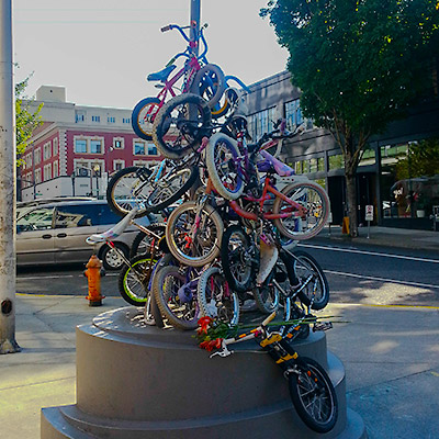
A bike sculpture, Burnside and 13th Av. intersection, Portland, OR
We still prefer more modern styles. After asking for direction, we walked towards the shopping district. We had a rest at Pioneer Courthouse Square and felt that it’s where we belong to.
Light Rail, Downtown Portland, OR
Pioneer Courthouse, Portland, OR
Street food carts. (CNN declared Portland home to the world’s best street food).
We had dinner at Yama Sushi & Sake Bar in Pearl District. This seems to be a high-end section of the city. The arrangement of streets, stores and parks are well considered and organized. According to explorethepearl.com, “the Pearl is clear validation that high-quality, inner-city communities can revive from the ashes of urban decay”
North Park Blocks, Portland, OR
Jamison Square, Pearl District, Portland, OR
We left the city by NW Fremont Bridge. Overlooked the city by the river from this direction, it’s lovely and alive. My original impression had changed.
The next day morning, we drove along the Columbia River and went to see Multnomah Falls. Only 30 minutes from the city, the park offers quite magnificent view of this two-step waterfall.
Multnomah Falls, Oregon
We plan to visit the city again before flying back home. However, northbound highway 84 was shutdown for road construction. All the local roads were quite jammed. We eventually gave up and had a lunch at Thai Seasons restaurant. One side of wall is dedicated to the restaurant’s mission statement writing on the blackboard, to buy local and to be environmental friendly.
We left the city at afternoon and concluded our 4-day trip to Mt. Rainier and Portland, Oregon. A short and rewarding get away.