2018.7.2
During lunch time, the yacht returned from Fernandina Island to Isabela Island. The yacht docked at Punta Vicente Roca, which is located at the mouth of seahorse-shaped Isabela Island. The western side of the Ecuadorian volcano collapsed into the sea, leaving only half of the mountain attached to the island. Ecuadorian volcano is the smallest among the six volcanoes on Isabela Island.

Punta Vicente Roca is a good place for snorkeling because it is located near the equator, where wildlife converge because several ocean currents meet here. After lunch, we first dived in the bay near the crater, probably because there are more plankton, the water here is not very clear. There are many sea turtles, almost within reach.
When it comes to the diversity and uniqueness of the flora and fauna of the Galápagos Islands, it is important to talk about the geographical location and geography of the islands. Like Hawaii and Tahiti, the Galápagos Islands are volcanic islands. Instead of being located where the earth’s plates meet, these islands are in the central part of the plates. The popular explanation for the high volcanic activity is attributed to the hotspots in the Earth’s mantle, and the Galápagos Islands are on top of such a hotspot. The release of energy from the hotspot causes the formation of volcanoes, and the eruptions form islands that move eastward with the plate they are on. Therefore, the eastern islands of the Galapagos Islands are more ancient, and the western-most Fernandina Island is the youngest, only about seven hundred thousand years old.
The newly formed islands had intense volcanic activity, the soil was infertile. The surface was mostly covered with volcanic rocks and it was difficult for plants to survive. As the altitude of volcano increased, precipitation increased; the accumulation of plants and animals also slowly improved the soil, and forests gradually formed in the higher elevations of the mountains. Santa Cruz Island is representative of this type of island in the intermediate stage. The eastward shift of the plate took the island out of the hotspot and volcanic activity stopped. Because of self-weight and weathering, the volcanoes gradually collapsed and slowly sank into the sea. This is the fate of all the islands of the Galápagos Islands, and the whole process took about two to three million years.

Volcanic remains as far back as 7 or 8 million years have also been found underwater further southeast in the Galápagos Islands, and the emergence of islands in this region may be as far back as tens of millions of years. The volcanic islands were separated by seawater, allowing species to evolve independently; and the islands were not so far apart that a small number of plants and animals were able to migrate to the emerging islands and begin a new evolutionary process. Those islands that sank to the bottom of the sea did not stop evolving; they provided nutrients and habitat for marine life.

After the snorkeling, we took a short break and reboarded the zodiac. The zodiac departed from the southern end of the crater and slowly floated south along the rocky shore wall. There were several pairs of Nazca Boobies, some with their young, on the rocks jutting out from the shore. It’s just a pity that the wind and waves were too strong here and the zodiac undulates so much that it’s hard to get a clear picture.

As the zodiac continued south, the rock walls here are made of layers of volcanic rocks. Various birds are nesting and landing on this steep rock wall.


There is a large cavern in the small bay on the south side of the crater, probably formed by the flow of magma, similar to a lava tunnel.

Such top-to-bottom cracks can often be seen in the rock walls, which are vertical faults between rocks. The volcanic activity caused the fault to split and the magma to pour in, creating such a geological structure. The intensity of volcanic activity in this area is evident.

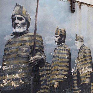
Leaving Punta Vicente Roca, we’re heading back to the central islands of the archipelago tonight, circling around Seahorse Head of Isabela Island. The boat would cross the equator as it headed north. It is a tradition for ships on long voyages to hold a ceremony for the crew of the ship crossing the equator for the first time. Like a Halloween celebration, the crew dresses up in fancy costumes, usually with someone dressed as Neptune, and there are often crazy antics during these ceremonies.
The location of the Galápagos Islands also contributes to its diversity of species. The Cromwell Current, also known as the Equatorial Current, is an ocean current that runs west to east across the Pacific Ocean at about 100 meters below the surface. Cold currents from the Panama Basin in North America and Peru in South America meet the Cromwell Current at the Galapagos Islands, which are located on the equator. The cold currents rise to the surface when they reach the islands, bringing large numbers of microorganisms to the surface and nourishing the life in the waters around the islands. In some years, for unknown reasons, these cold currents weaken, causing the temperature of the sea surface to rise, and an El Niño phenomenon is formed.

Traditions need to be observed, but of course our celebration was much more civilized. Everyone on board gathered in the cockpit of the boat, Marco poured a glass of champagne for everyone, and we gathered around the GPS device, waiting for the moment of crossing. When the number on the panel jumped to zero, everyone broke out in cheers. After the celebration, the captain also let the young boys on board to drive the boat himself.

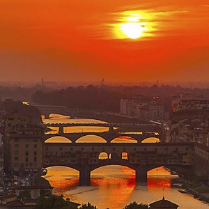
The sun is gradually setting at sea level. Tonight the boat will sail out of the area surrounded by islands again. It will be a bumpy night.